
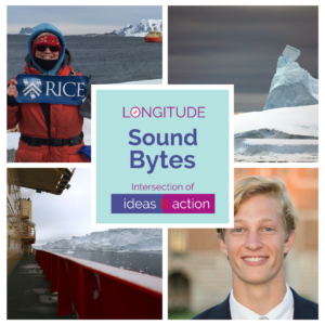
Longitude Sound Bytes
Ep 114: Seafloor Sampling in Antarctica (Listen)
Louis Noel
Welcome to Longitude Sound Bytes, where we bring innovative insights from around the world directly to you.
As part of our series focusing on science expeditions in harsh environments, our conversations aim to shed light on fascinating projects that help us understand our planet and life on earth better.
I am Louis Noel, a graduate student at Rice University pursing a master’s in engineering management and leadership.
For this episode, I had an opportunity to speak with Linda Welzenbach Fries, the science communicator in the Department of Earth, Environment and Planetary Sciences at Rice University. She is also an avid science photographer who has participated in several expeditions in Antarctica, including one aboard a research vessel that was taking samples from the Thwaites Glacier to help us understand the changes in the ice sheet.
We will be exhibiting photographs from her expeditions at the Rice University library this spring. This episode provides a bit of background on the THOR expedition through my conversation with Linda. We start off with Linda speaking about what THOR stands for and how it is part of a large international collaboration. Enjoy!
Linda Welzenbach Fries
THOR is an acronym for Thwaites Glacier Offshore Research. It is one of eight projects that is part of the International Thwaites Glacier Collaboration. This is a collaboration that is really big. It’s joint with the Natural Environmental Research Council, which is the UK version of the National Science Foundation. It’s the biggest of its kind in 70 years and is multi-millions of dollars. There are eight projects of which THOR is one. The purpose of this entire sort of collaboration is to study what is happening with Thwaites Glacier. And the reason for that is Thwaites Glacier is very large. It’s about the size of the UK, or maybe even the state of Florida in terms of its extent. It is very vulnerable to the rising temperatures of the ocean. So, they want to know what is happening presently, so some of the projects are studying the active dynamics of the of the glacier itself, and then there are others that are looking at what has happened in the past. So we can combine that with our present observations and past observations to better predict what might happen to that glacier in the future because it has a significant potential contribution to sea level rise. They’re talking upwards of a meter or a meter and a half.
Louis
My goodness, that would put a lot of cities in peril. Could you tell us the path that led you to be a part of this expedition?
Linda
Part of it was being in the right place at the right time. I started in my position as the science writer at the Department of Earth, Environmental Planetary Sciences late in 2016. One of the faculty, Dr. John Anderson, and his postdoc, Lauren Simkins, were working with several other scientists to write a proposal to be part of this particular collaboration. And they came to me and said, we have to write a National Science Foundation broader impact as part of this proposal. And those impacts are important because basically scientists are required now, essentially, to communicate the results of their scientific activities to the public. So, I was there at the right place to help them write this broader impact statement, and as part of that, when we were meeting together and talking about what we wanted that impact to be, they wanted to know, how would I feel about potentially being the outreach sort of person for one of the research cruises, not all of them. There were actually supposed to be two or three of them as part of the proposal. And they said, Hey, how would you like to go and, you know, report what the science activities on the boat were, as part of this project, so I said, of course.
Louis
Very cool. Could you speak about your role as a science writer and photographer on the research cruise?
Linda
One of the things that I’d propose to do as part of my participation on the project, if I was on the cruise was basically to write sort of regular blogs. Of course, when you write a blog, you also want to have, you know, a lot of imagery to go with it. Images are worth a lot of words. And we have a limit on the amount of data that can be transmitted once we get down below 60 degrees, because everything is done by satellite. And most of the communications are for safety and navigation reasons. And so, we all have a limit on how much data can be moved off the ship and back to the mainland. Really good pictures with some good text, that sort of combination, was something that I had not really done before. And so I did a little bit of learning along the way. I also happened to be drafted to help out with a lot of the scientific activities too, because they were shorthanded. And so that in and of itself was quite important and useful as part of my outreach activities because when you’re actively participating, you have a better feel for the kinds of images that tell the story.
Louis
Very cool. Yeah, I can tell that some hands-on experience probably informed some cool shots to take and maybe put you in the line of action, where you may get some shots you may not have. I actually read one of the blogs and it was so cool, just walked you day by day of things you were experiencing. It seems like the expedition, just to get there is an adventure of itself. So, could you kind of walk me through the nature of the science cruises? You know, maybe like what happens at first, like getting there, and then some of the general work of the scientists?
Linda
First thing I want to say is, this is my first and only cruise. I haven’t done any cruises before this. I’ve been to Antarctica, which is part of the reason why they said, hey, would you mind going- we think you would make a good member of the team. You know what it’s like to basically work under sort of difficult conditions and help to get things done.
Most of the research cruises to Antarctica leave from Punta Arenas, Chile. That is the most optimal location. It’s the shortest distance to basically work that is along the Antarctic Peninsula and down [and] around into the Amundsen Sea embayment to study these very vulnerable glaciers.
The transit from Punta Arenas to the Amundsen Sea embayment, which was our ultimate destination, was going to take somewhere in the neighborhood of 7 to 10 days, three-to-four-day transit across Drake’s passage, and then another three or four days, essentially, to pass along the peninsula and into the embayment, which is a very difficult place to get to.
We have satellite observations over the last 25 years, which is another sort of motivator, because they’d seen these dynamical changes in the glacier over this period of time, but we had very little sort of up-close data of the glacier itself to support what we were observing.
This particular cruise that I went on was also essentially sort of an orientation cruise for a number of the projects. In fact, THOR wasn’t the only project going on this cruise. We had GHOST, and this is one of the ITGC projects that is looking at how the glacier advanced and retreated. And they’re looking at the sort of the surface features of the glacier on islands and various other places. One of the other projects on this particular cruise was TARSAN, and they have a multifaceted group that does a bunch of different things, most of which is oceanographic. As part of that, they were conducting sea trials for this particular autonomous underwater vehicle called the HUGIN. It looks a lot like a torpedo. It was bright orange. They did an initial test, because we had to figure out not only how to get into the water, but how to retrieve it. When we started that trip, it was beautiful. The skies were very, very sunny. And this is an area that’s notorious for bad weather.
Louis
What time of the year is this?
Linda
We usually leave at the end of January. This was a two-month cruise, so we were essentially leaving around the 28th of January, we’re supposed to get back into port around the 24th of March. We were going to spend one day working out the kinks, the logistics, on deploying and retrieving the HUGIN from the water. We have a special team of technicians that essentially assist the scientists and all their scientific activities on board ship, they’re called marine technicians. It was their job, to go into the water with the Zodiac, and figure out how to retrieve this 1000+ pound piece of equipment and get it back into the sling so that they can haul it back on board. And when they went out to get it, the weather had turned, and the waves were really high. But they did. They managed to figure it out and then they were able to deploy it several more times when we actually got down to the Twaites Glacier.
Louis
I’d want to touch a little bit about the conditions of Antarctica. Could you describe some of the skill sets or mindset that are essential to be a part of an expedition like these?
Linda
The most important is to be able to cope with plans that don’t go the way you expect them to. Always have a plan B, even a Plan C or Plan D. Maintain sort of a positive outlook. Make sure that you are being aware of how you interact with everybody. You’re dealing with very, very few people who get very, very little sleep. There was something in the neighborhood of 50 scientists on this cruise and there are less than 20 people who actually manage the ship and help us out with the scientific activities. It’s astounding. Yeah, so being able to roll with it is really, really important. I think recognizing that it’s more about the science than it is about, everybody’s comfort. We’re there basically to accomplish some really amazing work. We have a unique opportunity. Everybody has to work together.
The skill sets are associated with the science that you have to do. So obviously, you have to understand how to run the equipment that you need to run and what data you’re collecting, and whether or not the data is actually good data so that you can solve problems on the fly. The ship essentially going toward its destination, it’s always collecting data. And that data is essentially the structure or the shape of the seafloor. That data is collected with a device called a multibeam echosounder. So, it’s using sound, sound waves essentially, to see the bottom of the sea floor.
Louis
So, it’s like more sophisticated sonar?
Linda
Yes.
Louis
Interesting.
Linda
They have an idea of the depth of the of the water column and the shape of the seafloor that it has literally bounced off of.
Louis
I believe that word is that word called bathymetry. Or is that just the science of studying it?
Linda
Yeah, that is the bathymetry. Seafloor bathymetry. What’s important about it is the different kinds [structures]. They know now, after many years of research, that the various shapes and structures that they see on the sea floor are definitely resulting from different kinds of movement of an ice shelf, or sliding material through turbidity currents, or you know, any kind of obvious, sort of marine geology event.
Louis
Is there any sort of like glacier intellect like this was formed by a glacier, 1000 – 2000 years ago by the seafloor or is it mainly just for more recent studies, like seafloor mapping?
Linda
Broadly speaking, the technology has been advancing significantly over the last couple decades, and so the detail that they are able to achieve with the multibeam echosounder is amazing. Actually, one of the goals of the of the HUGIN was to be able to provide similar kinds of data, but in even more detail because it would be located significantly closer to the [sea]floor so it could collect data at a much finer resolution than they can where the ship is sitting at the at the sea surface.
Louis
What do we learn from sampling glacier ice, and the sediments? And why are they valuable?
Linda
THOR’s primary function is looking at the geophysical sort of manifestation of ice sheet, advance and retreat [on the seafloor]. And then the other part of it is that they are basically collecting the sediments, because the sediments actually record a lot of information all the way back to the Last Glacial Maximum about what has happened on the seafloor, and what the ice sheet and the ocean have been doing over that period of time. And then they use that information from the past to basically model what potentially could happen in the future.
Louis
I see, so very valuable for climate science in general and geology. So fascinating. What’s the general approach for gathering samples?
Linda
There’s two ways they do that. The multibeam bathymetry is a good supporting activity, because it shows you the places on the seafloor that are optimal for potentially collecting samples. Then they also use another sort of semi-passive seismic, it’s called a sub-bottom profiler which basically uses a sound or ping that actually can penetrate somewhere in the neighborhood of up to 20 to 30 meters below the seafloor surface. And so then, what they look for, and this was actually one of my jobs on my shift, was to spend about four hours literally watching each and every ping of the sub-bottom profiler and looking specifically for areas where there’s sediment buildup in the neighborhood of a few 10s of meters, because those would be great areas to target for gathering or capturing sediment using one of the cores.
Louis
Could you please explain that a bit more how the core works?
Linda
Yes. There’s actually three cores. There is a core that samples just about the first upper meter, and there’s another core called the Kasten corer that is gravity core in which they literally has weights on top of it, and it punches its way down into the sediment. And then they have a Jumbo corer, which can gather even a deeper [sample]. It’s heavier and can gather even more sediment, a much larger volume, and much deeper section of seafloor sediment.
Louis
And then they bring it up and set it on a giant table and start doing the analysis, right?
Linda
Well, you have to like mud.
Louis
Yeah, I saw that picture. It’s just like mud.
Linda
So, the coring itself is obviously done by the technicians on board ship. They know what the right calculations are for the amount of speed and weight that are needed in a particular depth. They collect it, bring it back up on board, and then it is lowered in a horizontal position. Then they essentially leave the actual sort of moving of the core into the core laboratory to the scientists. So, we have to literally pick it up, put it on top of a dolly and wheel into the core lab. Then we clean it up, take the lid off, and then literally start processing the core.
Louis
Cool. What sort of instruments do you use to analyze the samples within the core?
Linda
The first thing you do is you use your eyes. Most of what you do on ship is prepare the core for shipment so that it can later then be studied by scientists. So, the first thing that they have to do is they literally clean the core up. Once you remove essentially the cap, you scrape the surface, so that you can actually see the layers, and that process can take several hours. And it’s a very careful process because you don’t want to disturb any of the layers. This is a fluid material. It’s a lot like peanut butter. And, so you want to be very, very careful about not disturbing the layers, which can be quite fine. From there, one of my jobs as the photographer was to actually take pictures once the core had been processed to also capture visually, the cores, you know, from the top to the bottom, to match it up with the actual description.
The other thing that we do with the cores is we subsample them for various types of scientific activities that really are time sensitive. And then after that, the core gets prepared, essentially for storage.
Louis
How many cores do you usually take?
Linda
We collected 26 cores, I think we did, or we made an attempt at 26 cores. I can’t remember any more how much we did. Part of not remembering everything is because everybody does 12-hour shifts. It is quite a day. And not only are you tired when you go to bed, you also have to somehow fit into that period of time, email, eating, showering, laundry, and so probably you’re up for maybe 18 hours. And so, sleep deprivation is a problem. Well, and there’s routine, and routine is good. With routine, you can basically start to not expend a lot of energy on making sure you’re doing what you need to do. You basically reduce the amount of energy that you need through routine.
Louis
Yeah, it involves a lot of thinking power if you are having to plan things every day but if you have a routine, it eliminates a big chunk of that. I’m sure it varied like day by day but what was a typical day like on the THOR expedition?
Linda
So for me, my shift was from noon to midnight. I would get up around 10 – 10:30 – 11, and I might actually process images that I took the day before or work on the blog that I started to work on. And then at noon, we would have an all hands meeting with the science PI who’s basically in charge of all the science activities going on aboard the ship. And he basically lays out what is happening each day. And that’s actually quite important.
The weather is dynamic. So, therefore that has a significant impact on how things will go throughout the day. So, we always have a plan B and a plan C to go along with that. Then I would spend that first four hours of my shift, looking at the sub-bottom profiler data, printing out or identifying those areas which I think are probably good candidates for coring. Then after that, I typically am on core-processing duty for the rest of the day. I may actually be part of monitoring the actual coring that’s going on itself, or sampling the core, or photographing the core, or doing one of the many activities associated with handling and managing the core. And then when I’m off at midnight. Midway through the cruise it’s daylight most of the time. We get some twilight, starting at like four-ish in the morning or something like that. It is twilight for a couple of hours and then it’s daylight again. So that’s kind of the time that I have to take pictures, or if somebody gets me up early enough, because there’s something really interesting to see, I might take pictures before I my shift starts. But once the shift starts, you are kind of tied to the tasks that you are in charge of. And it’s really important to complete those tasks too. There’s nobody else there to pick up the slack.
Louis
Very interesting. That sounds like quite the day and to do that day in day out. I mean, do you have the weekends off or is it every single day?
Linda
Every single day.
Louis
Wow. Are there any other instruments or tools, like the HUGIN on the research vessel that may be unusual? Like you wouldn’t expect it to be on a ship?
Linda
No. The thing that was really neat is, there’s a helipad on the ship but there was no helicopter.
Louis
Ah, bummer. No joy rides.
Linda
No joy rides. We’re never going to be in a situation where we were going to be within range for deploying a helicopter or carrying all that fuel so there were no helicopters.
The thing that I found the most fascinating was doing seal tagging. The TARSAN team was collecting data of the ocean and the ocean-ice interaction using very interesting science partners. And those science partners were seals because they can dive very, very deep, for longer periods of time, and go places that none of our instrumentation can go.
Louis
Genius!
Linda
What happens is they literally install [a CTD] on top of a seals’ head, which doesn’t harm the seal in any way. A [very] small version of the CTD. So, a CTD is an instrument that is deployed over the ship to collect information about the ocean from the surface to depth. It is a very large piece of equipment. Well, they have managed to miniaturize the CTDs for seals. And so their goal is to find seals that have shed all of the previous years’ fur, attach the CTD to their head, which will remain there until they molt the following year. And in that period of time, as the seals essentially go to the surface, and then dive and come back to the surface, the data that they collect in that period of time is transmitted back to the scientists in real time.
Louis
That’s so cool.
Linda
And they’re basically collecting all this data in a period of time that we can’t, you know, in the dead of winter, so we have a better idea of what is happening at the ocean-ice interface in periods of time that we cannot do any monitoring.
Louis
Very cool. Yeah, that’s genius.
Linda
They also have permission. They have to get very special permits in order to interact with these animals.
Louis
Was there anything unexpected you encountered during the expedition?
Linda
For me? Yes. Everything actually on this cruise was unexpected, because it’s something I’ve never done before. But that said, the crossing of Drake’s passage was pretty tough. It generally, at least according to most people, is tough because the weather is always bad. And in particular, when we made our crossing, there were actually two low pressure cyclones back-to-back. Yeah, so the waves were particularly rough. 20 feet, probably maybe more, it’s very difficult to tell, believe it or not, when you’re up high in on the on the bridge of the ship, it all just looks big. And, if I wasn’t on the bridge, I was basically sleeping, because the truth of the matter is, it makes you super, super tired to be in in that much motion.
Louis
Has the THOR project changed your skills or style of photography in any way?
Linda
Obviously, the more pictures you take, the easier it is to adjust to changing conditions. The environment in which you take the pictures, obviously is unique. So, there’s a learning curve associated with that. It helps you obviously learn to compensate for vibration. Lighting is very, very different there. Because out where it’s all ice, it’s very, very bright and very flat. So, you have to figure out ways to give depth to your images. There’s a big, big difference between doing photography for documentary science, versus taking pictures of things that are artistically pleasing and still making sort of both work together to tell a story. So that part of it, I think I learned a lot about that probably. It’s an improvement.
Louis
Judging by your photography website. It is fantastic. And I just want to say thank you again for coming to speak with us about glacier sampling and contributing not only about glacier sampling, but the meteorite search. It’s going to be a really cool exhibition that we put on for Rice and it’s a pleasure to have you as part of the Rice community too, so thank you.
Linda
My pleasure. Thank you.
[music]
Louis
We hope you enjoyed hearing about the science and adventure of the THOR expedition. Please visit Longitude [dot] site for the episode transcript.
If you are around Houston this spring, stop by the Rice University library to view an exhibition of photographs from Linda’s collection. Our exhibit will be available for display at other university libraries upon request.
If you are a college student interested in leading conversations for our next podcast series, please write to us at podcast@longitude.site.
Join us next time for more unique insights on Longitude Sound Bytes.